Official account of the USGS Volcano Hazards Program. We monitor and report on volcano activity in the U.S. and its territories.
-% der Follower von @usgsvolcanoes sind weiblich und -% sind männlich. Die durchschnittliche Engagement-Rate bei den Beiträgen liegt bei rund 2.4%. Die durchschnittliche Anzahl von Likes pro Beitrag beträgt 455 und die durchschnittliche Anzahl von Kommentaren beträgt 6.
@usgsvolcanoes liebt es, überNatur,
Bildung.

19,746
Follower

2.4%
Engagement Rate


461
Engagement pro Beitrag
455
Durchschnittliche Likes pro Beitrag
6
Durchschnittliche Kommentare pro Beitrag

1,243,274
Weltrang
-
Länderrang
-
Kategorierang
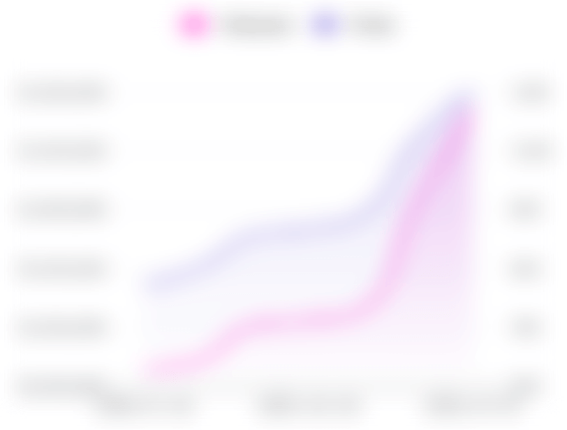
Follower- und Beitragswachstumstrends
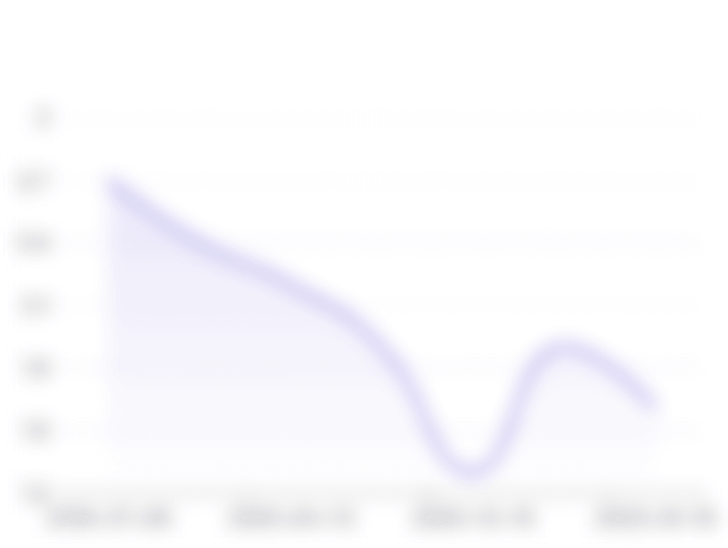
Wachstumstrends der Engagement-Rate
Publikumsgeschlecht

Dominierende Altersgruppe
Interessen
Erwähnungen - Konten

Engagement Rate

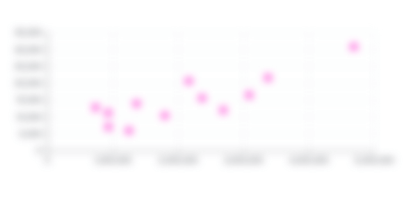
Likes und Kommentare
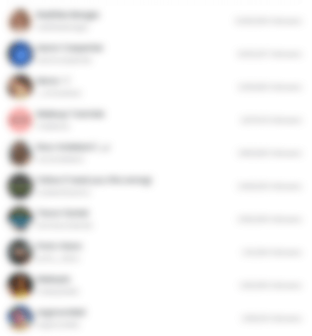
Bedeutende Influencer
Audience Brand Affinity
Ähnliche Konten


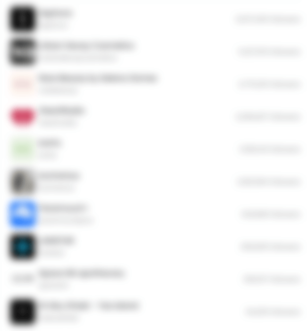
Aktuelle Beiträge


* Urheberrecht: Inhalteersteller sind standardmäßig die Urheberrechtsinhaber. Diese Informationen, einschließlich Bilder, Texte, Videos, Beiträge und Profile, werden auf öffentlichen Domains und den entsprechenden sozialen Medien zur öffentlichen Ansicht veröffentlicht.
FAQ: Instagram Statistiken und Einblicke für @usgsvolcanoes
Wie kann ich auf Instagram Statistiken und Analysen für @usgsvolcanoes zugreifen?
StarNgage bietet umfassende Analyseberichte, die wichtige Kennzahlen und Einblicke liefern, um ein umfassendes Verständnis von @usgsvolcanoes zu erhalten. Sie können verschiedene Aspekte erkunden, einschließlich Instagram Follower-Statistiken wie Follower- und Beitragswachstumstrends, Engagement-Rate und deren Wachstumstrends. Darüber hinaus können Sie Informationen über die durchschnittliche Anzahl von Likes und Kommentaren pro Beitrag, Einblicke in Ihre Follower- oder Publikumsdemografie, Markenaffinitätsdaten, Erwähnungen relevanter Hashtags, ähnliche Konten und die neuesten Beiträge erhalten.
Wie viele Follower hat @usgsvolcanoes derzeit auf Instagram?
Seit dem letzten Update hat @usgsvolcanoes auf Instagram eine engagierte Anhängerschaft von 19,746 Followern aufgebaut.
Welche Einblicke und Analysen sind in dem vollständigen Bericht für @usgsvolcanoes auf Instagram enthalten?
Unser vollständiger Instagram Analysebericht bietet einen umfassenden Überblick über @usgsvolcanoes auf Instagram. Dieser Bericht enthält detaillierte Informationen zum Wachstum der Follower im Laufe der Zeit, zu Engagement-Metriken und zur Beitragsfrequenz sowohl wöchentlich als auch monatlich. Um auf diesen umfassenden Bericht zuzugreifen, registrieren Sie sich bitte und erstellen Sie ein neues StarNgage-Konto oder melden Sie sich bei Ihrem bestehenden Konto an.
Kann ich verfolgen, wie sich die Engagement-Rate von @usgsvolcanoes auf Instagram entwickelt hat?
Ja, die Analysetools von StarNgage ermöglichen es Ihnen, die Entwicklung der Engagement-Rate von @usgsvolcanoes im Laufe der Zeit auf Instagram zu verfolgen. Diese Daten helfen Ihnen dabei, die Effektivität der Engagement-Strategien von @usgsvolcanoes zu bewerten.
Wie kann das Verständnis der Demografie des Publikums von @usgsvolcanoes auf Instagram nützlich sein?
Einblicke in die Demografie des Publikums von @usgsvolcanoes auf Instagram können äußerst wertvoll sein. Dies ermöglicht es Ihnen, Ihre Influencer-Inhalte und Marketingstrategien besser auf die Follower von @usgsvolcanoes abzustimmen, da Sie Informationen über Alter, Geschlecht, Standort und Interessen haben.
Wie kann ich Markenaffinitätsdaten nutzen, um meine Marketingstrategie auf Instagram mit @usgsvolcanoes zu verbessern?
Markenaffinitätsdaten sind ein mächtiges Instrument, um zu verstehen, welche Marken oder Produkte Ihr Publikum am meisten interessieren. Diese Informationen können Ihre Content-Kooperationen und Partnerschaften auf Instagram leiten und Ihre Bindung an Ihre Zielgruppe verbessern.